Why is this in the News?
- The Milestone: Bengaluru-based spacetech startup, Grahaa Space, has secured authorization from IN-SPACe (Indian National Space Promotion and Authorisation Centre) for its maiden mission.
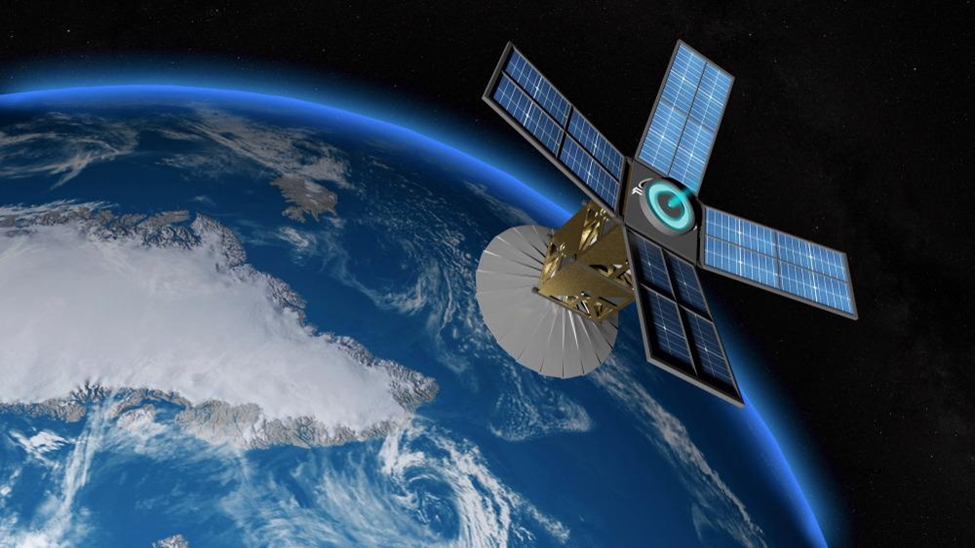
- The Mission: The launch of Solaras S2, a nano-satellite, is scheduled for late November as a technology demonstration.
What are the Mission Specifications?
- Launch Vehicle: The satellite will be launched aboard Hanbit-Nano, a rocket developed by the South Korean firm Innospace.
- Launch Site: The mission will lift off from the Alcântara Space Center (CEA) in Brazil.
- Primary Objective: To qualify the indigenous nano-satellite bus and platform, assessing its performance in orbit to validate readiness for future commercial operations.
Who are the Key Enablers?
- Regulatory Body: IN-SPACe provided the necessary regulatory clearance, facilitating private sector participation.
- Incubation Support: The startup is incubated at the Space Technology Incubation and Innovation Centre (STIIC) (referred to as TIIC in reports) at the Indian Institute of Space Science and Technology (IIST), Thiruvananthapuram.
Artificial Satellites: Classification and Utility
Conceptual Framework
- Definition: An artificial object intentionally placed into orbit around a celestial body (Earth, Moon, Mars) to perform specific tasks.
- Historical Precedent: The space age commenced with the launch of Sputnik 1 by the Soviet Union in 1957.
- Differentiation: Distinct from natural satellites (e.g., the Moon orbiting Earth).
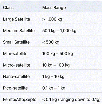
Classification by Mass
- Satellites are categorized based on their launch mass to determine launch vehicle requirements and mission scope.
Functional Classification
Satellites are broadly categorized into three domains based on their primary payload and orbital application:
Communication Satellites:
- Function: Act as orbital relay stations using transponders to amplify and redirect radio signals.
- Orbit: Predominantly placed in Geostationary Orbit (GEO) (~35,900 km) to maintain a fixed position relative to ground stations.
- Applications: Telecommunications, television broadcasting, and disaster management connectivity.
Earth Observation (Remote Sensing) Satellites:
- Function: Monitor Earth’s surface using active (radar) and passive (optical) sensors.
- Applications: Resource mapping (hydrology, geology), urban planning, meteorology, and military surveillance.
Navigation Satellites:
- Function: Transmit precise timing and geospatial data to allow receivers to determine location (latitude, longitude, altitude).
- Examples: GPS (USA), GLONASS (Russia), Galileo (EU), and NavIC (India).
ISRO Nano Satellite (INS) System
- Objective: A modular, low-cost platform developed by ISRO to support technology demonstration and academic research.
- Launch Mode: Deployed as a co-passenger alongside primary satellites on the PSLV.
- Specifications: Supports a total mass of 11 kg with a payload capacity of 3 kg.
- Strategic Utility: Provides a “launch-on-demand” bus for universities and R&D labs to test innovative payloads.
Challenges and Concerns
- Space Debris (Kessler Syndrome): Accumulation of defunct satellites and rocket stages increases collision risks, potentially rendering orbits unusable.
- Light Pollution: Large constellations (e.g., Starlink) reflect sunlight, interfering with ground-based astronomical observations.
- Radio Interference: Signal congestion in popular orbits can disrupt critical communication and GPS services.
- Environmental Impact: Rocket launches contribute to upper-atmosphere pollution, and re-entering debris may release toxic byproducts.