After reading this article you can solve this UPSC Model question-
"The recent adoption of a uniform 100-meter height criterion for defining 'Aravalli Hills' has raised significant scientific concerns regarding the protection of India’s oldest fold mountains. Analyze how such a height-based classification ignores the geomorphological reality of relict mountains and its implications for land degradation in Northwest India." 250 words (GS 1 Geography)
Context:
A landmark development in early 2025 is the Supreme Court’s reinforcement of the T.N. Godavarman (1996) judgment. The court has stayed any state-level attempts (particularly in Haryana) to redefine “forest” in a way that would exclude Aravalli hill tracts.
Significance of the Aravalli Range:
1. Barrier Against Desertification
The Aravallis act as a natural topographic barrier that prevents the eastward expansion of the Thar Desert. Without this range, the fertile plains of Haryana, Punjab, and Delhi-NCR would likely succumb to “sand-drift” and desertification.
2. Climate & Monsoon Regulator
- Rainfall Patterns: The range influences the South-West monsoon. Although it runs parallel to the Arabian Sea branch (which is why Rajasthan remains dry), it guides the Bay of Bengal branch of the monsoon towards the Northern Plains.
- Urban Heat Island Mitigation: For the National Capital Region (NCR), the Aravalli hills and forests act as a “green lung,” helping to lower local temperatures and combat the Urban Heat Island effect.
3. “Water Tower” for Northern India
- Groundwater Recharge: The fractured rocks of the Aravallis allow for high rates of percolation. It serves as a primary recharge zone for groundwater in water-stressed cities like Gurugram, Faridabad, and Delhi.
- Catchment Area: It is the source of several rivers, including the Banas, Luni, Sahibi, and Sakhi.
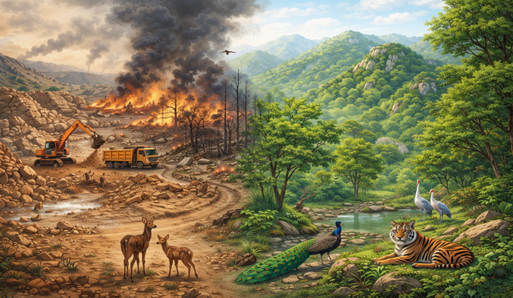
4. Biodiversity Hotspot
The range is a critical wildlife corridor, connecting the Sariska Tiger Reserve in Rajasthan to the Asola Bhatti Wildlife Sanctuary in Delhi. It hosts:
- Fauna: Leopards, Striped Hyenas, Golden Jackals, and various species of deer.
- Flora: Over 400 species of native plants, including the ecologically vital Dhok (Anogeissus pendula) tree.
5. Economic & Mineral Significance
The Aravallis are exceptionally rich in minerals, which has historically driven the regional economy:
- Non-Ferrous Metals: Large deposits of Copper (Khetri), Zinc, and Lead.
- Construction Material: High-quality Marble, Granite, and Sandstone (used in historical monuments like the Red Fort and modern infrastructure).
Challenges Faced by the Aravallis:
1. The “Definition” Crisis
The most pressing challenge in 2025 is the new uniform definition of the Aravallis accepted by the Supreme Court.
- The Issue: The definition now classifies “Aravalli Hills” as landforms with an elevation of 100 meters or more above local relief.
- The Threat: An internal assessment by the Forest Survey of India (FSI) found that only about 9% of the 12,081 hills mapped in Rajasthan meet this 100-meter criterion.
- Consequence: Nearly 90% of the hills, ridges, and slopes—which are lower but ecologically vital—could lose their protective “Aravalli” status, potentially opening them to legal mining and real estate development.
2. Systematic “Vanishing” of Hills (Illegal Mining)
- Physical Erasure: In Rajasthan alone, at least 31 out of 128 mapped hills have completely disappeared due to rampant illegal mining.
- Resource Depletion: The range is being razed for “Badarpur sand,” marble, and granite to feed the construction hunger of the NCR.
- Effect: The loss of these hills creates gaps in the desert barrier, allowing Thar Desert sand to drift into the Indo-Gangetic plains.
3. Acute Hydrological Stress
- Puncturing Aquifers: Deep mining has punctured underground water tables. In districts like Mahendergarh (Haryana), groundwater levels have plummeted to 1,500–2,000 feet.
- Loss of Catchment: Natural cracks in Aravalli rocks once recharged 2 million liters of water per hectare. Urbanization and cementing have blocked these recharge zones, turning Gurugram and Faridabad into “Dark Zones” where water extraction exceeds 200% of recharge.
4. Fragmentation of Wildlife Corridors
- Human-Wildlife Conflict: The range is a vital corridor for leopards and hyenas between Sariska (Rajasthan) and Asola Bhatti (Delhi).
- The Barrier: Massive infrastructure projects, such as the proposed highway plans through Aravalli forests, are cutting these corridors, leading to frequent leopard sightings (and deaths) on roads.
5. Invasive Species (The “Green Desert”)
- Prosopis juliflora (Vilayati Kikar): This invasive species has taken over large tracts. While it looks green, its allelopathic nature prevents native plants from growing and its deep taproots further deplete groundwater.
Recent Government & Judicial Steps:
1. Landmark Judicial Steps
The Supreme Court (SC) of India has recently passed several critical orders to end the “regulatory vacuum” that allowed illegal mining for decades.
- Uniform Definition: For the first time, the SC accepted a standardized definition for the Aravallis.
- “Aravalli Hill”: Any landform in designated districts with an elevation of 100 meters or more above local relief.
- “Aravalli Range”: A collection of two or more such hills within 500 meters of each other.
- Interim Ban on New Mining: The Court has banned the grant of all fresh mining leases and renewals across Delhi, Haryana, Rajasthan, and Gujarat until a comprehensive Management Plan for Sustainable Mining (MPSM) is finalized.
- Protection of PLPA Lands (2025): The Court reiterated that lands protected under the Punjab Land Preservation Act (PLPA) in Haryana are to be treated as “forests,” making any diversion for non-forest use (like real estate) illegal without prior Central approval.
2. Recent Government Steps
The Union Government and State administrations have launched multi-pronged initiatives to restore the “Green Shield” of Northern India.
- Aravalli Green Wall Project (AGWP) Expansion:
- Stretching 1,400 km from Porbandar to Panipat, the project is creating a 5 km wide green buffer.
- Context: In June 2025, the PM integrated the ‘Ek Ped Maa Ke Naam’ campaign into the AGWP, aiming to restore 1.1 million hectares of degraded landscape by 2027.
- Management Plan for Sustainable Mining (MPSM):
- The MoEF&CC, through the Indian Council of Forestry Research and Education (ICFRE), is drafting a geo-referenced plan.
- It will categorize the range into Core/Inviolate Zones (No mining) and Regulated Zones (Scientific mining allowed only for strategic minerals).
- The 2025 Action Plan: Unveiled by the Environment Ministry in May 2025, it emphasizes Native Species Plantation (Dhok, Salai, etc.) and the removal of invasive species like Prosopis juliflora.
Way Forward: How to Protect the Aravallis?
1. Revisiting the Legal Definition (The “100m Challenge”)
The most critical task is ensuring that smaller hills are not left vulnerable.
- Slope-Based Mapping: Instead of a strict height cutoff, the government should adopt the Forest Survey of India’s (FSI) recommendation of a 3 to 4.5-degree slope criterion. This ensures that even low-lying ridges, which act as vital windbreaks and groundwater recharge zones, remain protected.
- “Relict Landscape” Protection: The Aravallis are relict mountains; many of their most ecologically significant parts are now low-elevation. Legislation must recognize geological age (rocks of the Aravalli Supergroup) rather than just physical height.
2. Unified Aravalli Management Authority
Currently, the range is managed by four different states (Gujarat, Rajasthan, Haryana, Delhi) with varying laws.
- Statutory Body: A central authority modeled after the National Mission for Clean Ganga (NMCG) should be established to ensure uniform land-use policies.
- Natural Conservation Zone (NCZ) Integrity: The Regional Plan 2041 for NCR must be strictly enforced, keeping Aravalli lands under the NCZ category where construction is restricted to 0.5%.
3. Implementing the “Saranda Model” for Sustainable Mining
The Supreme Court has directed the creation of a Management Plan for Sustainable Mining (MPSM), similar to the one used for Jharkhand’s Saranda forests.
- Inviolate Zones: Identify “No-Go” zones for mining, specifically in wildlife corridors (e.g., between Sariska and Asola Bhatti) and primary aquifers.
- Ecological Restoration Bond: Mining leases should only be granted if the company deposits a “Restoration Fund” upfront to be used for mandatory reclamation of abandoned pits once mining ends.
4. Scaling the Aravalli Green Wall Project (AGWP)
The 1,400 km x 5 km corridor must be treated as a National Priority Project.
- Native Species Re-wilding: Replacing invasive Prosopis juliflora (Vilayati Kikar) with native species like Dhok, Salai, and Kair.
- The “Whole-of-Society” Approach: Using MGNREGA and the Green Credit Programme to involve local villagers in nursery development and tree planting, ensuring the “Ek Ped Maa Ke Naam” campaign has high survival rates.
5. Digital Monitoring & Community Vigilance
- Satellite Audits: Real-time monitoring through ISRO’s Bhuvan portal to issue automated alerts for any topographic change or illegal construction.
- “Van Panchayats”: Empowering village-level committees to manage “Gair Mumkin Pahar” (uncultivable hilly lands) through eco-tourism and non-timber forest produce (NTFP), giving them a financial stake in conservation.
Conclusion:
The Aravallis are not merely “hills” but a life-support system for the National Capital Region. Their destruction would lead to the irreversible desertification of North-West India. As noted in recent environmental summits, protecting the Aravallis is a vital component of India’s commitment to the Bonn Challenge (restoring 26 million hectares of degraded land by 2030).