
About TRISHNA
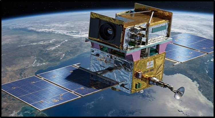
- TRISHNA (Thermal InfraRed Imaging Satellite for High-resolution Natural Resource Assessment) is a joint ISRO–CNES Earth-observation mission.
- Launch & Platform: Planned for 2027 aboard PSLV from Satish Dhawan Space Centre; based on ISRO’s IMS-1K satellite bus.
- Orbit: 761-km Sun-synchronous polar orbit, ~90° inclination, 8-day revisit cycle, with ~12:30 PM equatorial crossing.
- Lifespan: Designed for 5 years.
Payload Architecture
- VSWIR Payload (ISRO): 7 spectral bands—5 VNIR and 2 SWIR—for vegetation monitoring, cloud/cirrus detection, snow mapping, water-vapour estimation, aerosols and burnt-area assessment.
- TIR Payload (CNES): 4 long-wave infrared (8–12 µm) bands for land-surface temperature/emissivity retrieval and atmospheric correction.
- Swath & Resolution: 1,030-km swath; 57 m resolution over land/coasts (60 m near shorelines) and 1 km over oceans/polar regions; ~3 acquisitions per 8 days at the equator, rising to 6 at 60° latitude.
Radiometric & Sensor Performance
- Thermal Sensitivity: NeDT <0.2 K (~0.5 K at Level-1C), with 0.5 K temperature knowledge and 1.5 K land/sea surface temperature accuracy.
- Pointing & Registration: Geolocation accuracy of 3 GSD, multi-temporal co-registration 0.9 GSD, and interband co-registration 0.6 GSD (3σ).
- Sensor Engineering: Uses miniaturized cryocoolers and compact cryostats manufactured using Additive Layer Manufacturing (ALM).
Applications & Data Products
- Water & Food Security: Monitors evapotranspiration and water stress to improve irrigation and agricultural water management.
- Environmental Monitoring: Tracks water quality, urban heat, geothermal/volcanic anomalies, glaciers, snowmelt and aerosols.
- Data Products: Generates surface temperature, emissivity, vegetation indices, albedo and daily evapotranspiration; data will be free and openly accessible with ~12-hour processing latency.
- Global Support: Supports GEOGLAM, Global Water Watch and SDGs, and serves as a precursor to ESA’s Copernicus LSTM mission.
Conclusion
TRISHNA combines ISRO’s optical VSWIR sensing with CNES’s thermal infrared imaging to deliver high-resolution surface temperature and water-stress data, supporting agricultural, coastal, and climate-monitoring applications while serving as a technological precursor to future global thermal-imaging missions.
| This concept has been elaborately discussed in the following article – TRISHNA Mission |