
About NAQUIM
Implemented by the Central Ground Water Board (CGWB) under the Ministry of Jal Shakti, NAQUIM is India’s premier scientific initiative designed to study underground water-bearing formations. Operating on the core principle of “Know your aquifer, manage your aquifer,” the programme shifts national groundwater policy from blind extraction to evidence-based, sustainable governance.
Strategic Objectives
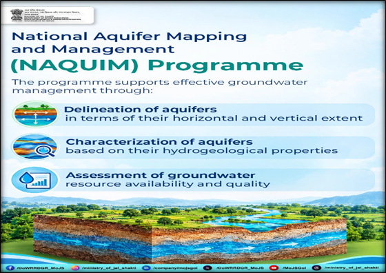
- 3D Aquifer Mapping: Delineating aquifer boundaries, characterizing their geometry and thickness, and mapping subterranean resources in three dimensions.
- Resource Assessment: Evaluating the exact quantity and quality of available groundwater to identify zones of hydrological stress, rapid depletion, and chemical contamination.
- Decentralized Planning: Translating complex hydrogeological data into practical, area-specific management plans to support participatory water governance by local administrations.
The Management Dimension
- NAQUIM transcends mere scientific mapping by delivering actionable Aquifer Management Plans.
- These plans guide local authorities in implementing artificial recharge structures, enforcing rainwater harvesting, regulating extraction rates, mitigating quality issues, and adjusting crop and irrigation patterns to suit local water availability.
Scale of Mapping (Phase 1.0)
- National Coverage: During Phase 1.0, the programme successfully mapped the entire demarcated mappable area of India, covering approximately 25 lakh square kilometers.
Transition to NAQUIM 2.0
- High-Resolution Granularity: NAQUIM 2.0 transitions the programme from macro-regional mapping to highly granular, high-resolution assessments (1:10,000 scale).
- Targeted Interventions: It focuses exclusively on acutely water-stressed, over-exploited, and critical micro-watersheds across the country.
- Micro-Level Planning: Designed to deliver actionable, Panchayat-level and taluk-wise hydrogeological data, serving as the scientific baseline for localized operational interventions and converging with schemes like the Atal Bhujal Yojana and PMKSY.
Key Outputs of NAQUIM
- Scientific Deliverables: Generates comprehensive 3D aquifer maps, hydrogeological models, and groundwater-quality assessments.
- Administrative Tools: Produces tailored district and taluk-level aquifer reports, explicitly outlining localized recommendations for safe extraction, targeted artificial recharge, and community-based water conservation.
Conclusion
NAQUIM effectively bridges the critical gap between complex hydrogeological science and grassroots water administration. By translating 3D aquifer mapping into actionable, micro-level management plans, the programme acts as the definitive roadmap for securing India’s long-term groundwater sustainability.
| This Concept Has Been Mentioned In This Article: Anatomy of India’s Groundwater Crisis and Agrarian Inequality |