
Important for GS Prelims: GEOGRAPHY
Key Features
- The Cauvery (Kaveri) is one of the major east-flowing peninsular rivers of India.
- It is often called the “Ganga of South India” because of its cultural, economic, and religious significance.
- It is an inter-State river flowing through Karnataka, Tamil Nadu, and parts of Kerala and the Union Territory of Puducherry.
- Forms the Shivanasamudra Falls, one of India’s famous waterfalls.
- Creates the fertile Cauvery Delta, known as the “Rice Bowl of Tamil Nadu.”
- Supports irrigation, drinking water supply, hydroelectric power generation, and fisheries.
Source and Course
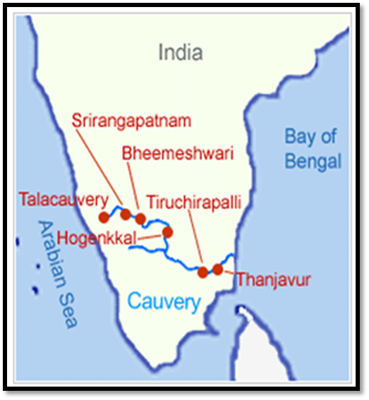
- Source: Talakaveri, located in the Brahmagiri Hills of the Western Ghats, Kodagu (Coorg), Karnataka.
- Length: Approximately 805 km.
- Mouth: Empties into the Bay of Bengal near Poompuhar (Tamil Nadu).
- Drainage Basin: About 81,155 sq. km.
Major Tributaries
| Left-bank Tributaries | Right-bank Tributaries |
| Harangi Hemavati Shimsha Arkavati | Kabini Bhavani Noyyal Amaravati |
| Major Dams and Reservoirs Krishna Raja Sagara (KRS) – Karnataka Mettur Dam (Stanley Reservoir) – Tamil Nadu Kabini Dam Harangi Dam Hemavati Reservoir | National Parks in the Basin Nagarhole National Park Bandipur National Park Brahmagiri Wildlife Sanctuary |
Conclusion:
- The Cauvery River is the lifeline of southern India, known for its unique geographical features, major tributaries, important dams, fertile delta, and significant role in inter-State water sharing.
| This concept has been elaborately discussed in the following article: Cauvery Water Dispute: CWMA, CWRC and the Water-Sharing Mechanism |