
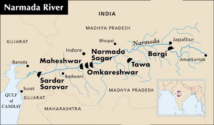
Important for GS Prelims: GEOGRAPHY
Overview
- The Narmada River is the largest west-flowing river of Peninsular India.
- It is the fifth-longest river in India and the third-longest river in Peninsular India, after the Godavari and Krishna.
- It is also known as the “Lifeline of Madhya Pradesh” and “Rewa”.
- Forms an estuary because the continental shelf is narrow and tidal action is strong.
Basic Facts
| Particular | Details |
| Source (Origin) | Narmada Kund, Amarkantak Plateau, Maikal Hills, Anuppur District, Madhya Pradesh |
| Elevation of Source | About 1,057 metres above mean sea level |
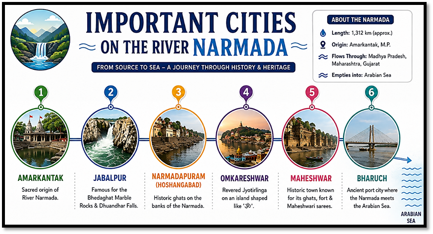
| Mouth | Gulf of Khambhat (Cambay), Arabian Sea, near Bharuch, Gujarat |
| Type of Mouth | Estuary (does not form a delta) |
| Length | 1,312 km |
| Drainage Basin | Approximately 98,796 sq. km |
| Flow Direction | Westward |
| States Covered | Madhya Pradesh, Maharashtra (border), Gujarat |
| Sea into which it drains | Arabian Sea |
| Left-bank Tributaries | Banjar, Sher, Shakkar, Burhner, Choral, Karam |
| Right-bank Tributaries | Tawa (Largest tributary), Hiran, Kolar, Dudhi, Goi, Ganjal, Barna |
Important Waterfalls, Projects, National Parks and Protected Areas
| Important Waterfalls Dhuandhar Falls (Jabalpur) Kapildhara Falls Dugdhdhara Falls | Major Dams and Multipurpose Projects Sardar Sarovar Dam – Gujarat Indira Sagar Dam – Madhya Pradesh Omkareshwar Dam – Madhya Pradesh Bargi Dam – Madhya Pradesh Maheshwar Dam – Madhya Pradesh Tawa Dam – On the Tawa River (largest tributary) | National Parks and Protected Areas Satpura National Park Kanha National Park (basin) Pench National Park (basin) Shoolpaneshwar Wildlife Sanctuary (Gujarat) |
Conclusion:
- The Narmada River is India’s largest west-flowing peninsular river, renowned for its rift valley course, estuarine mouth, and strategic geographical, ecological, and hydropower significance.
| This concept has been elaborately discussed in the following article: Cabinet Approves ₹5,070 Crore Scheme to Promote Floating Solar Plants |