Context
Recently, the Supreme Court of India took suo motu (on its own motion) cognisance of rampant illegal sand mining in the National Chambal Gharial Sanctuary.
- Court Observation: The Bench (Justices Vikram Nath and Sandeep Mehta) termed it an “environmental crisis” caused by “administrative indifference” and “greed.”
- Key Directives: Mandatory installation of high-resolution Wi-Fi-enabled CCTV cameras at mining routes.
- Pilot project for GPS tracking on all mining-related vehicles in Morena (MP) and Dholpur (Rajasthan).
- Warning to deploy paramilitary forces if states fail to take concrete measures by May 11, 2026.
1. The Chambal River System
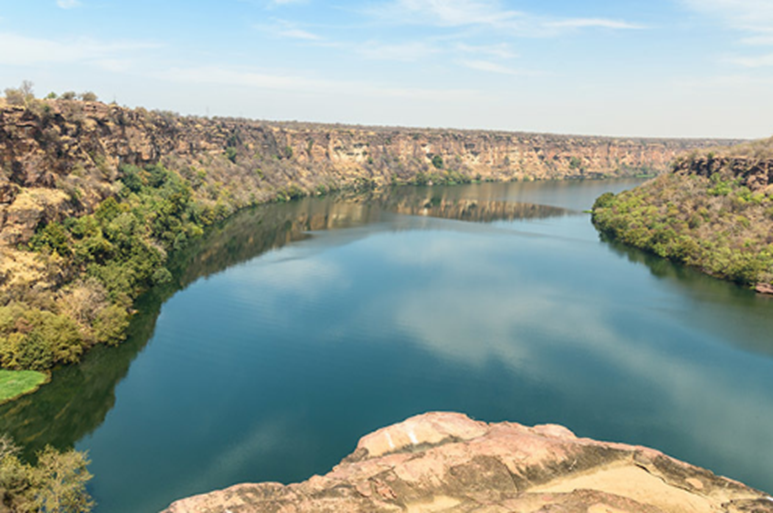
The Chambal River is unique as it is one of the least polluted rivers in India, primarily due to its rugged “badland” topography which historically restricted human settlement.
- Origin: Rises in the Vindhya Range (Janapav hills near Mhow, Madhya Pradesh).
- Course: Flows North-Northeast through MP, runs through Rajasthan, forms the boundary between Rajasthan and MP, and eventually joins the Yamuna River in Jalaun district, UP.
- Tributaries: The primary tributaries are Banas, Mej, Parvati, Kali Sindh, and Shipra.
- Topography: Famous for Chambal Ravines (Badland Topography) caused by gully erosion.
- Dams (Chambal Valley Project)
(a) Gandhi Sagar (MP)
(b) Rana Pratap Sagar (Rajasthan)
(c) Jawahar Sagar (Rajasthan)
(d) Kota Barrage (Rajasthan)
- Famous cities: Kota, Rawatbhata, Sheopur
- Famous sites:
- Garadia Mahadev Temple: Panoramic river gorge views in Kota.
- Bhainsrorgarh Fort: Historic fort atop a 250-ft cliff overlooking the river.
- Bateshwar Temples: Cluster of 200+ ancient sandstone temples near riverbanks.
- Machkund Temple (Dholpur, Rajasthan): A holy site located about 4 km from Dholpur.
3. Ecology: National Chambal Gharial Sanctuary (NCS)
Established in 1979, this is a tri-state protected area (Madhya Pradesh, Rajasthan, and Uttar Pradesh).
| Feature | Details |
| Primary Fauna | Gharial (Gavialis gangeticus), Red-crowned roof turtle, Ganges River Dolphin. |
| Gharial Status | Critically Endangered (IUCN Red List); Schedule I of Wildlife Protection Act, 1972. |
| River Dolphin Status | Endangered (IUCN Red List). |
| Vegetation | Kathiar-Gir dry deciduous forest ecoregion; characterized by thorny shrubs. |
| Other Species | Mugger crocodile, Smooth-coated otter, Indian Skimmer (bird). |
4. Key Threats & Legal Provisions
- Sand Mining: Destroys the nesting grounds of gharials and turtles who use sandy banks to lay eggs.
- Legal Framework:
- Section 35 of Wildlife Protection Act (1972): Relates to Declaration of National Parks/Sanctuaries.
- Environment Protection Act (1986): Regulates activities in Eco-Sensitive Zones (ESZ).
- Sustainable Sand Mining Management Guidelines (2016): Issued by MoEFCC to promote scientific mining.
- Article 142: It demonstrates the court’s ability to issue “complete justice” orders, such as mandating the use of GPS and CCTV—technologies not explicitly mentioned in older environmental statutes but necessary for modern enforcement.
Consider the following statements regarding the Chambal River system:
1.	It originates in the Vindhya Range and flows into the Yamuna River.
2.	It forms part of the boundary between Rajasthan and Madhya Pradesh.
3.	Its basin is characterized by fertile alluvial plains with dense agricultural settlement.
4.	It is considered one of the least polluted rivers in India.
Which of the statements given above are correct?
(a) 1, 2 and 4 only
(b) 1 and 3 only
(c) 2, 3 and 4 only
(d) 1, 2, 3 and 4
Answer: A
Explanation:
•  Statement 1 is Correct: The Chambal River originates in the Vindhya Range (specifically the Janapav hills near Mhow, MP). It flows north-northeast and is a major tributary that joins the Yamuna River in the Jalaun district of Uttar Pradesh.
•  Statement 2 is Correct: The river serves as a natural boundary between the states of Rajasthan and Madhya Pradesh for a significant stretch of its course.
•  Statement 3 is Incorrect: This is a classic "trap" statement. The Chambal basin is actually famous for its Badland Topography, characterized by extensive ravines (gullies) caused by severe soil erosion. This landscape makes the area largely unsuitable for dense agricultural settlement compared to the fertile plains of the Ganga.
•  Statement 4 is Correct: Due to the rugged ravine terrain and the lack of industrialization along its banks, the Chambal is widely recognized as one of the cleanest and least polluted major rivers in India. This purity is why it supports sensitive species like the Critically Endangered Gharial and the Gangetic River Dolphin