Context
Recent satellite imagery from the NISAR satellite has revealed that Mexico City is sinking at an alarming rate of nearly 50 cm per year, making it one of the world’s fastest-subsiding metropolises.
1. Geomorphological Background
- Location & Terrain: Mexico City is built atop an ancient lake bed.
- Historical Context: Historically, indigenous groups used canals (chinampas), but modern urban development has led to massive land alterations.
- Key Cause: The primary driver of subsidence is excessive groundwater pumping and urban development, which causes the underlying aquifer to shrink and compact.
2. Impact of Land Subsidence
- Infrastructure Damage: Subsidence causes tilting and structural damage to monuments (e.g., Metropolitan Cathedral, Angel of Independence), housing, and critical infrastructure like the subway and drainage systems.
- Water Crisis: The contracting aquifer contributes to a chronic potable water shortage.
- Magnitude: In less than a century, some parts of the city have dropped by more than 10 meters.
3. Science and Technology: The NISAR Mission
- Definition: NISAR stands for NASA-ISRO Synthetic Aperture Radar.
- Collaboration: It is a joint initiative between NASA (USA) and ISRO (India).
- Capability: It tracks real-time changes on the Earth’s surface with high-resolution “hair-thin” discrimination.
- Global Utility: Beyond urban subsidence, the technology is used to track:
- Natural disasters and fault line changes.
- Climate change effects in regions like Antarctica.
- Volcanic eruption warning systems.
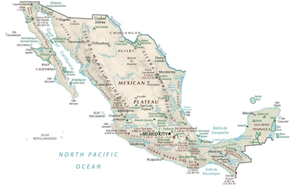
4. Geographical Features
- Located in North America, south of United States.
- Bounded by Pacific Ocean (west) and Gulf of Mexico & Caribbean Sea (east).
- Major landforms:
- Sierra Madre Occidental (west) and Sierra Madre Oriental (east) mountain ranges
- Mexican Plateau (central highland region)
- Highest peak: Pico de Orizaba (Citlaltépetl) – a volcanic mountain
- Major rivers:
- Rio Grande (forms US–Mexico border)
- Lerma, Balsas
5. Borders & Location
- Shares land borders with:
- United States (north)
- Guatemala and Belize (southeast)
- Maritime proximity to Caribbean islands
- Important strategic location for North American trade
6. Economic Features
- Classified as an upper-middle-income economy
- Member of OECD
- Key sectors:
- Manufacturing (automobiles, electronics)
- Oil (state company Pemex)
- Agriculture (maize, coffee, sugarcane)
- Major export partner: United States
- Important concept: Maquiladora industries (export-oriented factories near border)
7. Environment & Climate
- Lies in tropical and subtropical zones
- Climate types:
- Arid (north), tropical (south), temperate (central highlands)
- Part of Mesoamerica Biodiversity Hotspot
- Rich biodiversity: tropical rainforests, deserts, mangroves
With reference to land subsidence in Mexico City, consider the following statements:
1. The city is built on an ancient lake bed.
2. Excessive groundwater extraction is a major cause of subsidence.
3. Subsidence leads to expansion of aquifers beneath the city.
Which of the statements given above are correct?
(a) 1 and 2 only
(b) 2 and 3 only
(c) 1 and 3 only
(d) 1, 2 and 3
Answer: (a) 1 and 2 only
Explanation:
•  Statement 1 is Correct: Mexico City is built on the bed of the former Lake Texcoco, an ancient lake system. This soft, water-rich sediment makes the ground highly susceptible to subsidence.
•  Statement 2 is Correct: Excessive groundwater extraction is the primary cause of subsidence. When water is pumped out, the underlying aquifer loses pressure, causing the soil layers to compact and sink.
•  Statement 3 is Incorrect: Subsidence does not expand aquifers. Instead, it causes compaction and shrinking of aquifer spaces, reducing their water-holding capacity and worsening water scarcity.