Context
Recently, India’s indigenous navigation system, NavIC (Navigation with Indian Constellation), faced a technical challenge following the failure of an atomic clock onboard the IRNSS-1F satellite in March 2026. This development is significant as it reduces the number of fully operational satellites providing precise Positioning, Navigation, and Timing (PNT) services. While the satellite remains in orbit for one-way messaging, the loss of its timing frequency highlights the critical need for India to accelerate the launch of its second-generation NVS series satellites to maintain a robust and independent regional navigation network.
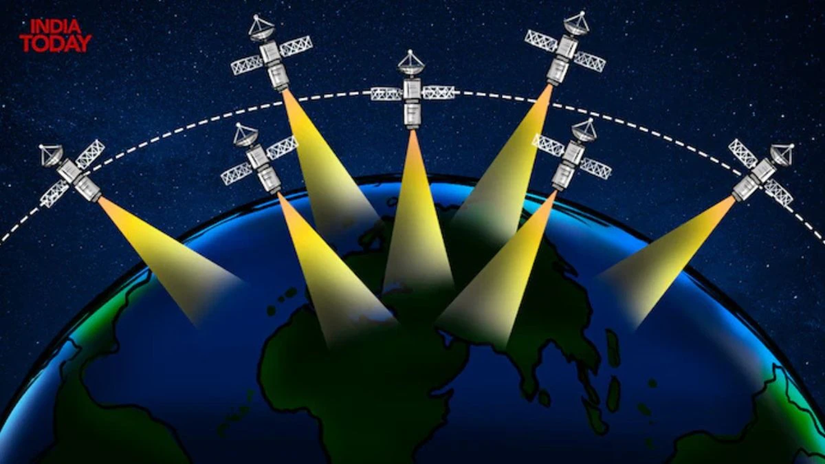
1. NavIC: India’s Indigenous Navigation System
NavIC, formerly known as the Indian Regional Navigation Satellite System (IRNSS), is an independent regional system developed by ISRO.
- Constellation Design: It originally consisted of 7 satellites.
- 3 satellites are in Geostationary Orbit (GEO) (appearing fixed over the equator).
- 4 satellites are in Geosynchronous Orbit (GSO) (inclined at 29° to the equatorial plane).
- Coverage Area: Primary Service Area: Entire Indian landmass and an area extending up to 1,500 km beyond its borders.
- Services Provided:
- Standard Positioning Service (SPS): Open for all civilian users (accuracy < 20 meters).
- Restricted Service (RS): An encrypted service for authorized users (military and strategic applications).
- Frequency Bands: Initially used L5 and S bands. The new NVS satellites have added the L1 band, which is common in civilian GPS, making NavIC compatible with most smartphones and wearable devices.
2. Global vs. Regional Systems
The world’s navigation systems are categorized based on their coverage:
| System Name | Country/Region | Type | Number of Satellites |
| GPS | USA | Global (GNSS) | 24+ (MEO) |
| GLONASS | Russia | Global (GNSS) | 24+ (MEO) |
| Galileo | European Union | Global (GNSS) | 30 (MEO) |
| BeiDou | China | Global (GNSS) | 35+ (MEO/GEO/GSO) |
| NavIC | India | Regional | 7 (GEO/GSO) |
| QZSS | Japan | Regional | 4 (GSO/GEO) |
Note: Global systems primarily use Medium Earth Orbit (MEO) to ensure worldwide visibility, whereas regional systems like NavIC use higher orbits (GEO/GSO) to remain focused over a specific geography.
3. The Role of Atomic Clocks
Atomic clocks are the “heart” of navigation satellites. They measure time based on the vibrations of atoms (usually Rubidium or Cesium).
- Principle: Navigation works via trilateration. The satellite sends a signal with a timestamp; the receiver calculates distance based on the time delay.
- Precision: Even a nanosecond error can lead to a positioning error of several meters.
- Indigenous Progress: Earlier IRNSS satellites used imported rubidium clocks which faced frequent failures. ISRO has now developed indigenous Space-qualified Rubidium Atomic Clocks, first flown in the NVS-01 satellite in 2023.
Q. With reference to the 'Navigation with Indian Constellation' (NavIC), consider the following statements:

1. NavIC provides global coverage similar to the Global Positioning System (GPS) of the United States.

2. The constellation uses a combination of satellites in Geostationary and Medium Earth Orbits.

3. The second-generation NVS satellites include the L1 frequency band to enhance interoperability with civilian devices.

Which of the statements given above is/are correct?
A) 1 and 2 only
B) 3 only
C) 2 and 3 only
D) 1, 2 and 3

Solution: B

•	STATEMENT 1 IS INCORRECT: NavIC is a regional navigation system, not a global one. It covers India and an area of 1,500 km around it.
•	STATEMENT 2 IS INCORRECT: NavIC uses a combination of Geostationary (GEO) and Geosynchronous (GSO) orbits, not Medium Earth Orbit (MEO). GPS, GLONASS, and Galileo use MEO.
•	STATEMENT 3 IS CORRECT: The new NVS series satellites (starting with NVS-01) incorporate the L1 band to improve compatibility with commercial smartphones and wearables.